Dataset
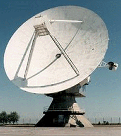
UTLS-Ozone DCFZ campaign: CFARR Chilbolton Advanced Meteorological Radar images
Update Frequency: Not Planned
Latest Data Update: 2005-01-13
Status: Completed
Online Status: ONLINE
Publication State: Published
Publication Date: 2007-03-13
Download Stats: last 12 months
Dataset Size: 958 Files | 184MB
Abstract
Data from the Upper Troposphere Lower Stratosphere (UTLS) programme's round 1 research project "Dynamics and Chemistry of Frontal Zones" (DCFZ). DCFZ investigated the role of frontal shear zones in determining upper tropospheric chemical distributions. This dataset contains Chilbolton radar images.
Citable as: Chilbolton Facility for Atmospheric and Radio Research (2007): UTLS-Ozone DCFZ campaign: CFARR Chilbolton Advanced Meteorological Radar images. NCAS British Atmospheric Data Centre, date of citation. https://catalogue.ceda.ac.uk/uuid/7025e0c5730cdea0e18669c75cd1688b
Abbreviation: Not defined
Keywords: UTLS, DCFZ, Radar
Details
| Previous Info: |
No news update for this record
|
|---|---|
| Previously used record identifiers: |
http://badc.nerc.ac.uk/view/badc.nerc.ac.uk__ATOM__dep_11737983925117086
|
| Access rules: |
Public data: access to these data is available to both registered and non-registered users.
Use of these data is covered by the following licence: http://www.nationalarchives.gov.uk/doc/open-government-licence/version/3/. When using these data you must cite them correctly using the citation given on the CEDA Data Catalogue record. |
| Data lineage: |
Data were given to the BADC from Chilbolton Facility for Atmospheric and Radio Research (CFARR). |
| Data Quality: |
See documentation for details about known quality issues with these data
|
| File Format: |
Images are JPG formatted
|
Related Documents
No documents related to this record were found.
Process overview
This dataset was generated by instruments deployed on platforms as listed below.
Instrument/Platform pairings
| Chilbolton Facility for Atmospheric and Radio Research (CFARR) Chilbolton Advanced Meteorological Radar (CAMRa) 3 GHz S-Band Radar | Deployed on: Chilbolton Atmospheric Observatory (CAO) |
| Output Description | None |
No variables found.
Coverage
Temporal Range
Start time:
1999-01-15T00:00:00
End time:
1999-03-29T23:00:00
Geographic Extent
60.0000° |
||
-20.0000° |
10.0000° |
|
50.0000° |
Related parties

