Dataset
GBS 20.7GHz slant path radio propagation measurements, Chilbolton site
Abstract
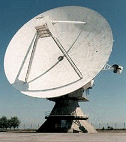
The GBS (Global Broadcast Service) dataset is a series of radio attenuation measurements made at three sites in the UK: Chilbolton and Sparsholt, both in southern UK, and Dundee in Scotland. The aim of the experiment was to make long term measurements of the signal strength received from a 20.7GHz beacon on the US Department of Defense satellite UFO-9 at multiple sites, in order to determine whether the use of site diversity as a fade mitigation technique would be effective. The dataset spans a period of 3 years, from August 2003 to August 2006 with signal attenuation sampled once per second.
This dataset is cited in:
S. A. Callaghan, J. Waight, J.L.Agnew, C. J. Walden, C.L.Wrench , S. Ventouras “The GBS dataset: measurements of satellite site diversity at 20.7 GHz in the UK”, Geoscience Data Journal, 17 March 2013, DOI: 10.1002/gdj3.2
Details
| Previous Info: |
No news update for this record
|
|---|---|
| Previously used record identifiers: |
http://badc.nerc.ac.uk/view/badc.nerc.ac.uk__ATOM__dep_11902119479621181
|
| Access rules: |
Access to these data is available to any registered CEDA user. Please Login or Register for a CEDA account to gain access.
Use of these data is covered by the following licence(s): http://www.nationalarchives.gov.uk/doc/open-government-licence/version/3/ When using these data you must cite them correctly using the citation given on the CEDA Data Catalogue record. |
| Data lineage: |
Data are prepared by Chilbolton Facility for Atmospheric and Radio Research (CFARR) staff prior to submission to BADC for archiving. |
| Data Quality: |
Data are checked by CFARR staff prior to submission to BADC
|
| File Format: |
Data are netCDF formatted
|
More Information (under review)
Related Documents
| Data article in Geoscience Data Journal doi:10.1002/gdj3.2 |
Citations: 3
The following citations have been automatically harvested from external sources associated with this resource where DOI tracking is possible. As such some citations may be missing from this list whilst others may not be accurate. Please contact the helpdesk to raise any issues to help refine these citation trackings.
| Callaghan, S. (2014) Datasets: From Creation to Publication. Communications in Computer and Information Science, 3–9. https://doi.org/10.1007/978-3-319-08425-1_1 https://doi.org/10.1007/978-3-319-08425-1_1 |
| Callaghan, S. (2014) Datasets: From Creation to Publication. Communications in Computer and Information Science, 3–9. https://doi.org/10.1007/978-3-319-08425-1_1 https://doi.org/10.1007/978-3-319-14226-5_1 |
| Callaghan, S.A., Waight, J., Agnew, J.L., Walden, C.J., Wrench, C.L. & Ventouras, S. (2013) The <scp>GBS</scp> dataset: measurements of satellite site diversity at 20.7 GHz in the UK. Geoscience Data Journal 1, 2–6. https://doi.org/10.1002/gdj3.2 https://doi.org/10.1002/gdj3.2 |
Process overview
Instrument/Platform pairings
| GBS (Global Broadcast Service) satellite receivers | Deployed on: NCAS Chilbolton Atmospheric Observatory (CAO) |
| Output Description | None |
- units: dB
- long_name: Attenuation relative to clear sky
- var_id: clearsky_attenuation
- long_name: Axis of antennae sensitivity
- var_id: polarisation_receive
- var_id: ngr_receiver
- long_name: British National Grid Reference of receiver
- units: GHz
- long_name: Carrier wave frequency
- var_id: frequency
- units: degrees
- long_name: Elevation angle of the receiver
- var_id: elevation_angle
- units: m
- var_id: receiver_altitude_amsl
- long_name: Height of receiver above mean sea level (Ordnance Survey Great Britain)
- units: degrees_north
- var_id: latitude_receiver
- long_name: Latitude coordinate of the receiver
- units: degrees_east
- long_name: Longitude coordinate of the receiver
- var_id: longitude_receiver
- long_name: Name by which link is known
- var_id: link_id
- long_name: Polarisation of transmitted radiation
- var_id: polarisation_transmit
- units: degrees_west
- long_name: Position of the satellite
- var_id: satellite_position
- var_id: time
- units: seconds
- long_name: Time at end of integration period
Co-ordinate Variables
Temporal Range
2003-08-18T23:00:00
2005-03-30T23:00:00
Geographic Extent
51.1333° |
||
-1.4330° |
-1.4330° |
|
51.1333° |

