Dataset Collection
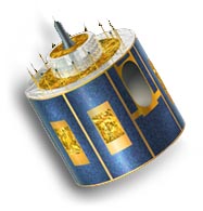
Meteosat Second Generation (MSG) Geostationnary Satellites: Visible, Infra-Red and Water Vapour Images and Derived Data Products over the world
In some products users may notice blank regions periodically appearing at the bottom and top of those images. This is related to the fact that the N-S oscillation of the IODC satell… Read More
Abstract
Meteosat Second Generation is operated by EUMETSAT and provides almost continuous images to meteorologists and researchers in Europe and around the world. It incorporates significant enhancements in frequency and resolution to the previous generation of Meteosat. MSG measures in 12 spectral channels (compared to only 3 on the previous Meteosat) and records data in a 15 minute cycle (30 minutes on the previous Meteosat). The resolution of the high-resolution visible light channel measures 1 km at the sub-satellite point (compared to 2.5 km on the previous Meteosat).
This dataset collection includes visible, infra-red, water vapour, High Resolution Visible (HRV) images and the derived cloud top height, cloud top temperature, fog, snow detection, and volcanic ash products. These images are available for a range of geographical areas. Images are available from March 2005 onwards at a frequency of 15 minutes (some are hourly) and are at least 24 hours old.
The different geographic extents for images within this dataset collection are available via the linked documentation 'MSG satellite imagery product geographic area details'. Each MSG imagery product area can be referenced from the third and fourth character of the image product name giving in the filename. E.g. for EEAO11 the corresponding geographic details can be found under the entry for area code 'AO' (i.e West Africa).
Details
| Previous Info: |
2022-06-22
Blank regions in some images and 'red line' artefacts. |
|---|---|
| Previously used record identifiers: |
http://badc.nerc.ac.uk/view/badc.nerc.ac.uk__ATOM__dataent_msg
|
Temporal Range
2004-02-14T00:00:00
Ongoing
Geographic Extent
90.0000° |
||
-101.7220° |
135.5000° |
|
-90.0000° |