Dataset Collection
Chilbolton Facility for Atmospheric and Radio Research (CFARR): surface, radar and lidar measurements (1998-present)
Abstract
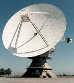
Data from observations made using Chilbolton Facility for Atmospheric and Radio Research (CFARR).The Science and Technology Facilities Council (STFC) facility at Chilbolton Observatory, Hampshire (51.1445N, 1.4270W) is the home of many observation systems for meteorological and atmospheric science research. There are 4 radar systems designed to study precipitation, clouds and clear air, of which the largest is the 3 GHz Doppler radar (CAMRa) on the 25 m dish. There are also 4 lidar systems providing data on elastic backscattering, Doppler velocity, water vapour profiles and depolarisation. A wide range of meteorological and multiple raingauge data are available from both Chilbolton and the nearby Sparsholt field site. There is a wide range of radiometers at the site: microwave (for water vapour and liquid water measurements) and downwelling infra-red and visible detectors for radiation budget measurements. This dataset holds attenuation time-series data from vertically polarised 5 km links from South Wonston to Sparsholt. Cloud camera data from the Chilbolton site are available to provide visual information on weather conditions.
CFARR is funded by the Natural Environment Research Council (NERC) and is owned and operated by the Space Science and Technology Department of the STFC.
Details
| Previous Info: | No news update for this record |
|---|---|
| Previously used record identifiers: |
http://badc.nerc.ac.uk/view/badc.nerc.ac.uk__ATOM__dataent_chobs
|
Related Documents
Temporal Range
1996-07-04T23:00:00
Ongoing
Geographic Extent
60.6822° |
||
-9.3737° |
3.5169° |
|
49.5381° |

