Dataset
Chilbolton Facility for Atmospheric and Radio Research (CFARR) Clear Air ACROBAT Radar Data
Abstract
Data were collected from the 4th of April 2002 to the present by the Ultra-violet Raman lidar at Chilbolton Observatory, Hampshire. The dataset contains measurement and display of the full Doppler spectrum, and the moments Z, v and w of air.
Details
| Previous Info: |
No news update for this record
|
|---|---|
| Previously used record identifiers: |
http://badc.nerc.ac.uk/view/badc.nerc.ac.uk__ATOM__ACTIVITY_5fe59594-fe4a-11e1-95fb-00163e251233
|
| Access rules: |
Access to these data is available to any registered CEDA user. Please Login or Register for a CEDA account to gain access.
Use of these data is covered by the following licence(s): http://www.nationalarchives.gov.uk/doc/open-government-licence/version/3/ When using these data you must cite them correctly using the citation given on the CEDA Data Catalogue record. |
| Data lineage: |
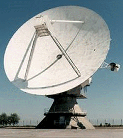
Data are collected by 4 radar systems, of which the largest is the 3 GHz Doppler radar (CAMRa), and 4 lidar systems, at Chilbolton Observatory, Hampshire. |
| Data Quality: |
Data are checked by CFARR staff prior to submission to BADC
|
| File Format: |
More Information (under review)
Data were collected from the 4th of April 2002 to the present by the Ultra-violet Raman lidar at Chilbolton Observatory, Hampshire.
The dataset contains measurement and display of the full Doppler spectrum, and the moments Z, v and w of air.
Further information about the CAESAR project can be found on the Science and Technology Facilities Council (STFC) CAESAR webpage, the Met Office CAESAR webpage, and the Facility for Airborne Atmospheric Measurements CAESAR webpage.
The STFC have a webpage which describes how and what data are collected by the clear air ACROBAT radar.
If you have queries about these pages or about obtaining the data from the BADC then you should contact CEDA Support. Your query should be answered within one working day. When follow-up work is required, the CEDA support will carry out the work as quickly and efficiently as possible, and in any case, the user will be kept informed of progress.
Related Documents
Process overview
Instrument/Platform pairings
| Output Description | None |
- long_name: Range Of The First Cloud Base From The Lidar
- names: Range Of The First Cloud Base From The Lidar
- units: degree
- long_name: absolute phase at horizontal polarisation
- var_id: PHI_H
- units: m
- long_name: antenna diameter
- var_id: antenna_diameter
- units: degree
- var_id: azimuth
- long_name: azimuth angle clockwise from grid north at the end of the beamwidth
- units: degree
- var_id: azimuth
- long_name: azimuth angle clockwise from the grid north at the start of the beamwidth
- units: Hz
- long_name: clock input to ISACTRL
- var_id: clock
- long_name: current state of file
- var_id: file_state
- long_name: dish_time
- var_id: dish_time
- units: m
- var_id: range
- long_name: distance from the antenna to the middle of each range gate
- units: m s-1
- long_name: doppler spectral width at horizontal polarisation from spectral processing
- var_id: SPW_HC
- units: degree
- var_id: elevation
- long_name: elevation angle above the horizon at the end of the beamwidth
- units: degree
- var_id: elevation
- long_name: elevation angle above the horizon at the start of the beamwidth
- units: GHz
- var_id: frequency
- long_name: frequency of transmitted radiation
- units: m
- standard_name: height
- var_id: height
- long_name: height of the elevation axis above mean sea level (Ordnance Survey Great Britain)
- units: degree
- long_name: horizontal angular beamwidth
- var_id: beamwidthH
- units: W
- long_name: peak transmitted power
- var_id: transmit_power
- long_name: pulse compression code
- var_id: pulse_compression_code
- units: us
- long_name: pulse period
- var_id: pulse_period
- units: Hz
- long_name: pulse repetition frequency
- var_id: prf
- units: dBZ
- long_name: radar reflectivity factor at horizontal polarisation from spectral processing
- var_id: ZED_HC
- units: m s-1
- var_id: VEL_HC
- long_name: radial velocity of scatterers away from instrument at horizontal polarisation from spectral processing
- units: dB
- long_name: signal to noise ratio at horizontal polarisation from spectral processing
- var_id: SNR_HC
- units: degree
- long_name: standard_deviation_of_absolute phase at horizontal polarisation
- var_id: PHI_HD
- units: degree
- long_name: verical angular beamwidth
- var_id: beamwidthV
Co-ordinate Variables
- units: degree_east
- standard_name: latitude
- var_id: latitude
- long_name: latitude of the antenna
- units: degree_north
- standard_name: longitude
- var_id: longitude
- long_name: longitude of the antenna
- long_name: time
- standard_name: time
- var_id: time
Temporal Range
2004-07-05T23:00:00
2007-02-06T00:00:00
Geographic Extent
51.1450° |
||
-1.4370° |
-1.4370° |
|
51.1450° |

