Dataset
ITALSAT radio propagation measurement at 40GHz in the United Kingdom
Update Frequency: Not Planned
Latest Data Update: 2009-10-07
Status: Completed
Online Status: ONLINE
Publication State: Citable
Publication Date: 2012-05-25
DOI Publication Date: 2012-05-27
Download Stats: last 12 months
Dataset Size: 1.37K Files | 2GB
Abstract
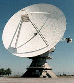
Measurements of tropospheric attenuation (excess and total) made at Sparsholt in Hampshire, UK using the ITALSAT satellite F1 beacon signal at 40 GHz.
Citable as: Science and Technology Facilities Council; Chilbolton Facility for Atmospheric and Radio Research; Ventouras, S.; Callaghan, S.A.; Wrench, C.L. (2012): ITALSAT radio propagation measurement at 40GHz in the United Kingdom. NCAS British Atmospheric Data Centre, 27 May 2012. doi:10.5285/4a60ee2f-0fd1-4141-9244-7bebf240bb49. https://dx.doi.org/10.5285/4a60ee2f-0fd1-4141-9244-7bebf240bb49
Abbreviation: Not defined
Keywords: CFARR, Chilbolton, radio propagation, 40 GHz
Details
| Previous Info: |
No news update for this record
|
|---|---|
| Previously used record identifiers: |
http://badc.nerc.ac.uk/view/badc.nerc.ac.uk__ATOM__ACTIVITY_52ad3c54-a663-11e1-ba03-00163e251233
|
| Access rules: |
Access to these data is available to any registered CEDA user. Please Login or Register for a CEDA account to gain access.
Use of these data is covered by the following licence(s): http://www.nationalarchives.gov.uk/doc/open-government-licence/version/3/ When using these data you must cite them correctly using the citation given on the CEDA Data Catalogue record. |
| Data lineage: |
Data are prepared by Chilbolton Facility for Atmospheric and Radio Research (CFARR) staff prior to submission to BADC for archiving. |
| Data Quality: |
Data are checked by CFARR staff prior to submission to BADC
|
| File Format: |
Data are netCDF formatted
|
More Information (under review)
Introduction
Tropospheric attenuation measurements made at Sparsholt in Hampshire, UK using the ITALSAT satellite F1 beacon signal at 39.6 GHz. ITALSAT F1 (owned and operated by the Italian Space Agency) was in geostationary orbit at 13 degrees east, and it could be seen from the receiving station at an elevation angle of 30 degrees. The received signal was cercularly polarised [RHCP] and was sampled once a second. North-south tracking of the satellite with the beacon receiver maintained ~20dB of dynamic range thought of the measurement period. The method applied to remove the nonatmospheric changes of the beacon signal and to establish the reference level from which to measure the excess and total attenuation is described in [Ventouras et.al., Long-term statistics of tropospheric attenuation from the Ka/U band ITALSAT satellite experiment in the United Kingdom, Radio Sci.,41,RS2007,doi:10.1029/2005RS003252]. The accuracy of fade level retrieval is estimated to be ~+/-0.5dB
Related Documents
No documents related to this record were found.
Citations: 2
The following citations have been automatically harvested from external sources associated with this resource where DOI tracking is possible. As such some citations may be missing from this list whilst others may not be accurate. Please contact the helpdesk to raise any issues to help refine these citation trackings.
| Callaghan, S. (2014) Datasets: From Creation to Publication. Communications in Computer and Information Science, 3–9. https://doi.org/10.1007/978-3-319-08425-1_1 https://doi.org/10.1007/978-3-319-08425-1_1 |
| Callaghan, S. (2014) Datasets: From Creation to Publication. Communications in Computer and Information Science, 3–9. https://doi.org/10.1007/978-3-319-08425-1_1 https://doi.org/10.1007/978-3-319-14226-5_1 |
Process overview
This dataset was generated by instruments deployed on platforms as listed below.
Instrument/Platform pairings
| ITALSAT 40GHz beacon receiver | Deployed on: Sparsholt College, Hampshire, UK |
| Output Description | None |
- units: dB
- long_name: attenuation relative to clear sky. It does not include gaseous attenuation
- var_id: excess_attenuation
- units: dB
- long_name: attenuation relative to vacuum. It includes all the propagation loss
- var_id: total_attenuation
- long_name: quality of both excess and total attenuation values
- var_id: flag
- long_name: time
- var_id: time
- units: seconds
Co-ordinate Variables
Coverage
Temporal Range
Start time:
1997-03-31T23:00:00
End time:
2000-12-31T00:00:00
Geographic Extent
51.0667° |
||
-1.4330° |
-1.4330° |
|
51.0667° |
Related parties

