Dataset
Chilbolton Facility for Atmospheric and Radio Research (CFARR) Galileo Cloud Radar Data
Update Frequency: Not Planned
Latest Data Update: 2014-12-20
Status: Completed
Online Status: ONLINE
Publication State: Published
Publication Date: 2003-09-14
Download Stats: last 12 months
Dataset Size: 1.91K Files | 7GB
Abstract
Data were collected from the 4th of April 2002 to the present by the Ultra-violet Raman lidar at Chilbolton Observatory, Hampshire. The dataset contains measurements of attenuated backscatter coefficients of aerosols within the atmosphere, and a full Doppler spectrum, and moments Z, v, and w.
Citable as: Science and Technology Facilities Council; Chilbolton Facility for Atmospheric and Radio Research; Natural Environment Research Council; Wrench, C.L. (2003): Chilbolton Facility for Atmospheric and Radio Research (CFARR) Galileo Cloud Radar Data. NCAS British Atmospheric Data Centre, date of citation. https://catalogue.ceda.ac.uk/uuid/bb9abe57099f15b70bf15279770b1e43
Abbreviation: Not defined
Keywords: CFARR, radar, cloud radar
Details
| Previous Info: |
No news update for this record
|
|---|---|
| Previously used record identifiers: |
http://badc.nerc.ac.uk/view/badc.nerc.ac.uk__ATOM__ACTIVITY_1757c734-fe4a-11e1-affe-00163e251233
|
| Access rules: |
Access to these data is available to any registered CEDA user. Please Login or Register for a CEDA account to gain access.
Use of these data is covered by the following licence(s): http://www.nationalarchives.gov.uk/doc/open-government-licence/version/3/ When using these data you must cite them correctly using the citation given on the CEDA Data Catalogue record. |
| Data lineage: |
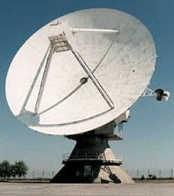
Data are collected by 4 radar systems, of which the largest is the 3 GHz Doppler radar (CAMRa), and 4 lidar systems, at Chilbolton Observatory, Hampshire. |
| Data Quality: |
Data are checked by CFARR staff prior to submission to BADC
|
| File Format: |
Data are netCDF formatted
|
Related Documents
Process overview
This dataset was generated by instruments deployed on platforms as listed below.
Instrument/Platform pairings
| Chilbolton Facility for Atmospheric and Radio Research (CFARR) 94 GHz Galileo Cloud Radar | Deployed on: NCAS Chilbolton Atmospheric Observatory (CAO) |
| Output Description | None |
- long_name: Air Temperature
- gcmd_url: http://vocab.ndg.nerc.ac.uk/term/P141/4/GVAR0027
- gcmd_keyword: Air Temperature
- names: Air Temperature, http://vocab.ndg.nerc.ac.uk/term/P141/4/GVAR0027
- long_name: Cloud Amount
- names: Cloud Amount
- long_name: Cloud Images
- names: Cloud Images
- long_name: Dew Point Temperature
- gcmd_url: http://vocab.ndg.nerc.ac.uk/term/P141/4/GVAR0210
- gcmd_keyword: Dew Point Temperature
- names: Dew Point Temperature, http://vocab.ndg.nerc.ac.uk/term/P141/4/GVAR0210
- long_name: Frequency
- names: Frequency
- long_name: Humidity
- gcmd_url: http://vocab.ndg.nerc.ac.uk/term/P041/4/G239
- gcmd_keyword: EARTH SCIENCE > Atmosphere > Atmospheric Water Vapor > Humidity
- names: http://vocab.ndg.nerc.ac.uk/term/P041/4/G239, EARTH SCIENCE > Atmosphere > Atmospheric Water Vapor > Humidity
- long_name: Humidity Mixing Ratio
- names: Humidity Mixing Ratio
- long_name: Number Of Cloud Bases
- names: Number Of Cloud Bases
- long_name: Precipitation Amount
- gcmd_url: http://vocab.ndg.nerc.ac.uk/term/P141/4/GVAR0656
- gcmd_keyword: Precipitation Amount
- names: Precipitation Amount, http://vocab.ndg.nerc.ac.uk/term/P141/4/GVAR0656
- long_name: Radar Reflectivity Factor
- names: Radar Reflectivity Factor
- long_name: Rainfall Drop Count
- names: Rainfall Drop Count
- long_name: Rainfall Tip Count
- names: Rainfall Tip Count
- long_name: Range Of The First Cloud Base From The Lidar
- names: Range Of The First Cloud Base From The Lidar
- long_name: Range Of The Second Cloud Base From The Lidar
- names: Range Of The Second Cloud Base From The Lidar
- long_name: Range Of The Third Cloud Base From The Lidar
- names: Range Of The Third Cloud Base From The Lidar
- long_name: Reflectance
- gcmd_url: http://vocab.ndg.nerc.ac.uk/term/P041/4/G212
- gcmd_keyword: EARTH SCIENCE > Atmosphere > Atmospheric Radiation > Reflectance
- names: EARTH SCIENCE > Atmosphere > Atmospheric Radiation > Reflectance, http://vocab.ndg.nerc.ac.uk/term/P041/4/G212
- long_name: Surface Winds
- gcmd_url: http://vocab.ndg.nerc.ac.uk/term/P141/4/GVAR0853
- gcmd_keyword: Surface Winds
- names: http://vocab.ndg.nerc.ac.uk/term/P141/4/GVAR0853, Surface Winds
- long_name: Temperature
- names: Temperature
- long_name: Wind Direction
- names: Wind Direction
- long_name: Windspeed
- names: Windspeed
Co-ordinate Variables
Coverage
Temporal Range
Start time:
1999-04-30T23:00:00
End time:
2009-01-15T00:00:00
Geographic Extent
51.1450° |
||
-1.4370° |
-1.4370° |
|
51.1450° |
Related parties

