Dataset
Total Ozone Mapping Spectrometer (TOMS): NIMBUS-7 Daily UV Exposure measurements at the Earth's Surface
Abstract
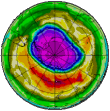
Data from the Total Ozone Mapping Spectrometer (TOMS), which used backscattered ultraviolet radiance to infer total column ozone measurements (gridded daily for the entire globe). This CD-ROM contains one file for each day from November 1, 1978 to March 6, 1993 (with a few missing days). Each file contains data representing the relative daily areal exposures of ultraviolet (UV) radiation effective in causing skin irritation, computed at each 1 degree latitude by 1.25 degree longitude pixel, between latitudes 65S and 65N. These data were derived from measurements made by NASA's Total Ozone Mapping Spectrometer (TOMS), which was flown aboard the Nimbus-7 satellite.
Details
| Previous Info: |
No news update for this record
|
|---|---|
| Previously used record identifiers: |
No related previous identifiers.
|
| Access rules: |
Public data: access to these data is available to both registered and non-registered users.
Use of these data is covered by the following licence(s): https://artefacts.ceda.ac.uk/licences/missing_licence.pdf When using these data you must cite them correctly using the citation given on the CEDA Data Catalogue record. |
| Data lineage: |
Data collected by NASA's Total Ozone Mapping Spectrometer (TOMS) and published on CD-ROM. A copy of the data were obtained by the BADC to assist in data access and to ensure long term preservation. |
| Data Quality: |
Data were prepared by NASA. Check documentation for further details
|
| File Format: |
Data are ASCII formatted and images are GIF formatted
|
Process overview
Instrument/Platform pairings
| NIMBUS-7 Total Ozone Mapping Spectrometer (TOMS) | Deployed on: NIMBUS 7 Satellite |
Mobile platform operations
| Mobile Platform Operation 1 | Mobile Platform Operation for: NIMBUS 7 Satellite |
Computation Element: 1
| Title | DETAILS NEEDED - COMPUTATION CREATED FOR SATELLITE COMPOSITE. deployed on NIMBUS 7 Satellite |
| Abstract | This computation involved: DETAILS NEEDED - COMPUTATION CREATED FOR SATELLITE COMPOSITE. deployed on NIMBUS 7 Satellite. The NASA Nimbus 7 research-and-development polar-orbiting satellite served as a stabilized, earth-oriented platform for the testing of advanced systems for sensing and collecting data in the pollution, oceanographic and meteorological disciplines. It was launched on October 24, 1978. |
| Input Description | None |
| Output Description | None |
| Software Reference | None |
| Output Description | None |
- long_name: Oxygen Compounds
- names: Oxygen Compounds
- long_name: Ozone
- gcmd_url: http://vocab.ndg.nerc.ac.uk/term/P041/4/G164
- gcmd_keyword: EARTH SCIENCE > Atmosphere > Atmospheric Chemistry/Oxygen Compounds > Ozone
- names: EARTH SCIENCE > Atmosphere > Atmospheric Chemistry/Oxygen Compounds > Ozone, http://vocab.ndg.nerc.ac.uk/term/P041/4/G164
- long_name: Total Ozone Column
- names: Total Ozone Column
- long_name: Ultraviolet Radiation
- gcmd_url: http://vocab.ndg.nerc.ac.uk/term/P141/4/GVAR0907
- gcmd_keyword: Ultraviolet Radiation
- names: Ultraviolet Radiation, http://vocab.ndg.nerc.ac.uk/term/P141/4/GVAR0907
Co-ordinate Variables
Temporal Range
1978-01-11T00:00:00
1993-05-05T23:00:00
Geographic Extent
90.0000° |
||
-180.0000° |
180.0000° |
|
-90.0000° |

